
Latakia Ridge Research Institute
The Search for Eden
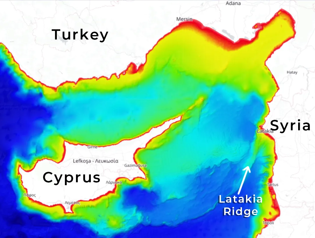
A submerged plateau in the basin between Cyprus and Syria, the Latakia Ridge about twenty miles off the Syrian coast, matches the Urantia Book's description of the first Garden of Eden: a peninsula that projected westward from the eastern Mediterranean and sank when the sea floor went down and the coast rose. Researcher Robert Sarmast has spent 30 years investigating what lies beneath the Mediterranean.
Images courtesy of Robert Sarmast / Latakia Ridge Research Institute, sunkenpeninsula.com
The Anomaly
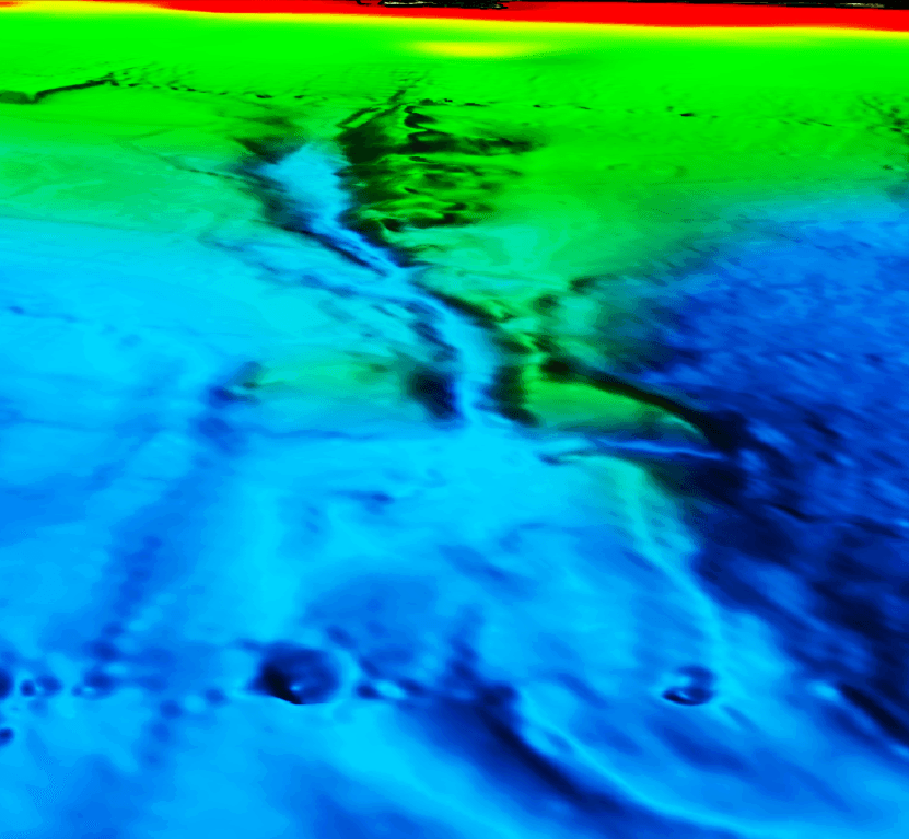
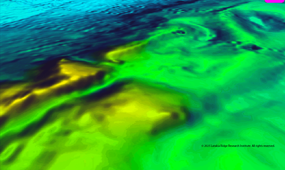
Between Cyprus and the Syrian coast, the Latakia Ridge rises from the Mediterranean seafloor. Its summit, now only approximately 550 meters below the surface, was once above water. Ten independent lines of geological evidence confirm this.
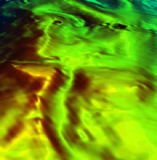
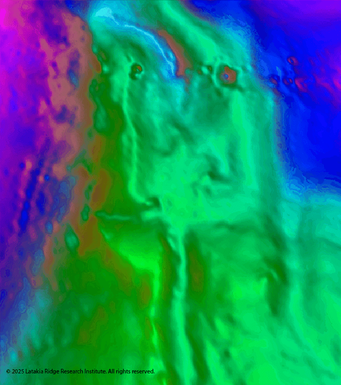
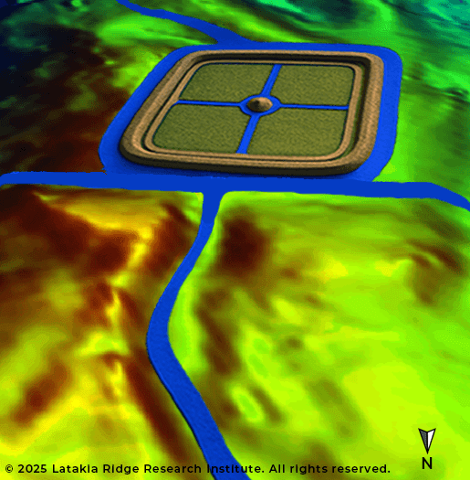
In 2025, AI-enhanced analysis of EMODnet bathymetric data revealed something unexpected: a flat rectangular basin with sharp edges, perimeter embankments, canal-like cuts, and mirrored triangular mounds. The statistical probability of these geometric features occurring naturally is less than 1 in 100,000.
Robert Sarmast, who has studied this site for over 30 years, is not claiming proof. He is announcing an anomaly he cannot yet explain, and inviting the scientific community to help test it. All bathymetric data is freely available for download and independent verification.
The Urantia Book Connection
Paper 73 of The Urantia Book describes the Garden of Eden as “a long narrow peninsula, almost an island, projecting westward from the eastern shores of the Mediterranean Sea.” The text provides specific geographic details: the peninsula was approximately 60 miles long, 27 miles wide at its widest point, with a narrow neck connecting it to the mainland.
The Latakia Ridge, when mapped at its former above-water elevation, matches these dimensions. The ridge extends westward from the Syrian coast, narrows to a neck-like connection near the mainland, and expands to a broader landmass further out, precisely the shape described in Paper 73.
According to the text, the Garden submerged approximately 34,000 years ago when the floor of the eastern Mediterranean sank, taking the peninsula and the surrounding coastline beneath the waves. The geological record of the region is consistent with this timeline.
The Sumerian paradise of “Dilmun” is often cited as a parallel to Eden. Paper 77 clarifies that the Sumerians actually confused three different locations under one name: Dalamatia (the Prince's sunken headquarters), the first Nodite capital, and the later Bronze Age settlement on Bahrain (77:4.8). The paradise memory the Sumerians attributed to Dilmun may preserve an echo of the first Garden itself, a place “where the gods first blessed mankind” that far exceeds what archaeology finds on Bahrain.
Paper 73:3.1
“The peninsula projected westward from the eastern shores of the Mediterranean Sea.”
Paper 73:3.3
“The coast line of this land mass was considerably elevated, and the neck connecting with the mainland was only twenty-seven miles wide.”
Paper 73:7.1
“The eastern floor of the Mediterranean Sea sank, carrying the whole Edenic peninsula beneath the waves.”
Paper 73:3.4
“The great river that watered the Garden came from the higher lands of the peninsula.”
Research Timeline
Open Data & Resources
Bathymetric Data
Download EMODnet data, 3D terrain models, and AI analysis results
The Sunken Peninsula
Latest research, book, and expedition updates from LRRI
Discovery of Atlantis (Book)
Robert Sarmast's original research connecting the UB with the Latakia Ridge
Read Paper 73
The Urantia Book's account of the Garden of Eden, full text with audio
About the Researcher
Robert Sarmast has dedicated over 30 years to investigating the Latakia Ridge as the possible location of the Urantia Book's Garden of Eden. His work bridges Urantia Book scholarship with marine geology, bathymetric science, and AI-assisted anomaly detection. In 2025, he rebranded his research under the Latakia Ridge Research Institute with a science-first approach, leading with testable hypotheses and open data rather than mythological framing. All of his research data is freely available for independent verification.